Cíes Islands Walks and Beaches: Rodas, the Lagoon and the Monte Faro Lighthouse Route
A day on the Cíes Islands is simple in the best way: a beach of fine white sand, clear water, pine woods, and paths that climb to lighthouses with views over the Atlantic. There are no roads, no cars and few buildings, and everything is done on foot. But the islands are bigger and hillier than they look from the boat, and a little planning helps you fit in both the famous beach and the famous walk.
This guide covers what to see and do once you land: Rodas beach and the lagoon behind it, the Monte Faro route to the main lighthouse step by step, the other viewpoints, the facilities, the rules of the national park, and suggested plans for a day.
Getting your bearings
- The archipelago has three islands, Monteagudo (north), do Faro (middle) and San Martiño (south); the first two are joined by a breakwater and by the sands of Rodas beach.
- Monteagudo and San Martiño are separated by a strait of about 500 m, the Freu da Porta.
- The highest point is Alto das Cíes, 197 m, on Monteagudo.
- All three islands are mountainous, with near-vertical western cliffs over 100 m high and many sea caves, while the gentler, sheltered eastern slopes hold woods, beaches and dunes.
In practice, this means the beaches face the mainland and the estuary, sheltered from the ocean, while the dramatic cliffs and seabird colonies are on the Atlantic side, reached by the paths to the lighthouses.
Rodas beach
The beach
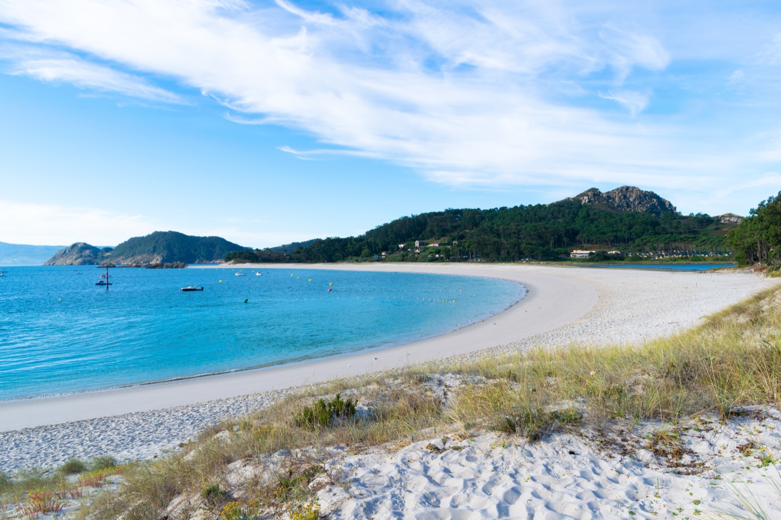
Rodas is the image of the Cíes: a long arc of white sand between the two northern islands, with turquoise water on one side and a lagoon on the other. Rodas beach is 1.3 km long and 60 m wide. Rodas is the most visited beach in Galicia, and its reputation spread far beyond Spain when, in February 2007, The Guardian named Rodas ‘the best beach in the world’.
A beach that joins two islands
Rodas is more than a beach: it is the sandbar that ties Monteagudo to Faro island. Behind it, the sea has formed a lagoon, and at high tide the sea flows between the two islands on the west side and fills the lagoon behind Rodas beach.
Swimming
The water is clear and, being the Atlantic, cool even in summer. Vigo usually provides beach lifeguards in summer, and a first-aid point operates only in high season, at the campsite. Swim within your limits and keep an eye on children. Outside the lifeguard season, there is nobody watching the water, so take extra care.
The lagoon
The lagoon, known as O Lago, sits behind Rodas beach and changes with the tide. When the water is clear, you can see fish, crabs and seaweed from the edge and from the dyke that crosses it. It has a history too: a tavern stood near the lake, which was used as a lobster nursery. Today it is one of the quietest corners near the jetty, and rest areas with stone tables are by O Lago, Nuestra Señora beach and the path to Figueiras beach.
The other beaches
Rodas is the most famous, but not the only beach. The archipelago has nine beaches in all, from small coves to the beach of Nuestra Señora on Faro island, which you pass on the way to the lighthouse. Walking a little further than the crowds at Rodas usually brings more space. The smaller beaches have no facilities at all, so bring what you need, and remember that the path back to the jetty always takes longer than you expect when the last boat is approaching. Treat each cove as a place to leave exactly as you found it: no shells taken, no rubbish left behind.
The Monte Faro route
The walk to the Cíes lighthouse, on the summit of Monte Faro, is the classic walk on the islands, and the best way to see their wild Atlantic side.
The essentials
- The Monte Faro route is 7 km there and back, takes about 2 h 30 min, is of medium difficulty and climbs 175 m.
- The lighthouse route is 3.5 km one way from the information hut and takes about 1 h 30 min.
Stage by stage
Across the dyke. From the information hut the path crosses the dyke to Faro island, past the lake and the campsite, reaching the nature interpretation centre in about 20 minutes. The dyke joining the two islands dates from the 19th century. Look into the lagoon as you cross; on clear days the water is full of life.
The interpretation centre. The centre is worth a short stop for its exhibition on the park’s natural and cultural values. It stands on history: in the 6th century two hermitages were founded, San Martiño on the south island and San Estevo on the middle island, on whose ruins the interpretation centre now stands.
Nuestra Señora beach. Just beyond the centre, the path reaches the beach of Nuestra Señora and the main junction on Faro island, where the climb begins.
Pedra da Campá. Halfway up, a detour leads to the Pedra da Campá, a rock pierced by salt-laden Atlantic winds; 100 m further on is the bird observatory, about 50 minutes from the start. The rock, with its wind-carved hole, is a striking sight on the way up.
The bird observatory. From the observatory you can watch thousands of nesting yellow-legged gulls and, with luck, shags nesting near the sea. The wooden hide lets you watch without disturbing the birds.
As Hortas. Near the top you can detour to the castro of As Hortas, the remains of a Bronze Age settlement, the oldest trace of people living on the islands.
The lighthouse. The final stretch zigzags up to the summit. At the lighthouse, 175 m cliffs drop away below you and the whole archipelago is in view, a giant breakwater sheltering the Vigo estuary from the Atlantic. Looking south, you see San Martiño across the strait.
Coming down. Return the same way, or extend the walk: on the way down, a turn-off links to the Faro da Porta route.
Tips for the walk
- Start early, before the heat and the crowds.
- Carry water; there is none to drink on the route.
- Wear proper shoes; the final zigzag is steep and stony.
- Watch the gulls in nesting season: keep to the path and do not approach nests.
When to walk
- Early morning is the best time for the lighthouse: cooler air, softer light and fewer people on the zigzag.
- Midday is best spent on the beach or in the shade of the pines by the lagoon.
- Late afternoon brings warm light for photographs, but watch the time of the last boat.
- Windy days make the summit exposed and chilly; bring a layer, and take care near the cliff edges.
- Hot days call for extra water, as there is none to drink on the route.
Other viewpoints
The main viewpoints are the Cíes lighthouse, Faro da Porta, the Monteagudo lighthouse, Pedra da Campá and Alto do Príncipe. Each offers a different angle on the islands:
- Faro da Porta looks across the Freu da Porta strait to San Martiño.
- The Monteagudo lighthouse, on the northern island, has a bird observatory beside it: there are two bird observatories, near the Pedra da Campá viewpoint and beside the Monteagudo lighthouse.
- Alto do Príncipe, on Monteagudo, completes the list of the park’s main viewpoints.
Wildlife along the way
The Cíes are as much about birds and sea life as beaches.
- Gulls. 22,000 pairs of yellow-legged gulls form the largest colony in the world, and 2,500 pairs of shags also breed here. They nest on the cliffs of the Atlantic side, which you look down on from the observatory and the lighthouse.
- A lost seabird. In 1960, 400 pairs of Iberian guillemots were counted; the species is now almost extinct on the islands, a reminder of how fragile these colonies are.
- At sea. Dolphins, whales and sea turtles regularly visit the waters around the islands, so keep an eye on the water from the boat and the viewpoints.
- Plants. Rare dune plants grow behind the beaches, including the endangered sea thrift, Armeria pungens; keep to the paths across the dunes.
History along the paths
The walk to the lighthouse is also a walk through the islands’ past.
- Bronze Age. The first settlement dates from the Bronze Age: the village of As Hortas on the slope of Monte Faro, also occupied in Roman times.
- Romans. The Romans called them the Islands of the Gods.
- Hermits. The interpretation centre stands on the ruins of the hermitage of San Estevo, founded in the 6th century.
- Pirates. The islanders left in the mid-16th century because of pirate raids, Francis Drake’s among them.
- Industry. Around 1840 two fish-salting factories were built, one where the Rodas restaurant now stands, and the lighthouse dates from 1852.
- Tourism and protection. Mass tourism began in the 1950s, and protection began in 1980, when Cíes was declared a natural park.
Photography
- Rodas from above, from the viewpoints and the path, to see the curve of sand and the lagoon together.
- The lighthouse at the top of Monte Faro, with the cliffs falling away below.
- Pedra da Campá, with the sea framed through the rock.
- The gull colonies from the observatory hides, with a long lens and without disturbing the birds.
- Early and late light, when the water turns deep blue and the crowds are thinner.
Facilities on the islands
The islands are a national park, not a resort, and facilities are basic.
- Water: there is no drinking water: the public fountains have no health guarantee, so bring water, though it can be bought at the islands’ eateries.
- Toilets: public toilets are on the path above the campsite, on the lighthouse route.
- Rest areas: by O Lago, Nuestra Señora beach and the path to Figueiras beach.
- First aid: a first-aid point operates only in high season, at the campsite, and Vigo usually provides beach lifeguards in summer; staff arrive on the first boat and leave on the last.
- Camping: the campsite is on Faro island, passed on the way to the lighthouse.
The rules while you are there
The park’s rules protect the islands, and knowing them avoids problems:
- Only walking is allowed on the paths; bicycles and other vehicles are not.
- Collecting shells from the beaches or seabed is not allowed.
- Leaving rubbish of any kind is forbidden, so take everything back with you.
- Fires of any kind are forbidden, as is camping outside the campsite.
- Drones and kites need express permission from the national park.
- Loudspeakers and noise that disturbs the natural peace are not allowed.
- Spearfishing and sport fishing are forbidden, and scuba diving with weights needs prior permission.
Plans for the day
The classic day
- Morning: from the jetty, start the Monte Faro route straight away while it is cool: the dyke, the interpretation centre, Pedra da Campá, the observatory and the lighthouse.
- Lunch: back down to a rest area by the lagoon or Nuestra Señora beach.
- Afternoon: Rodas beach for a swim and a rest.
- Before the boat: a last look at the lagoon from the dyke.
A beach day with a short walk
- Morning: settle on Rodas, or on a quieter stretch further along.
- Midday: walk around the lagoon and up to a viewpoint over the beach.
- Afternoon: swim, read and watch the boats until the ferry home.
A long day for walkers
- Morning: the Monte Faro route, adding the As Hortas detour.
- Afternoon: on to Faro da Porta, then across to Monteagudo for its lighthouse and observatory.
- Late afternoon: a swim at Rodas before the last boat.
Seeing the islands from the sea
Full-day sailing trip with a skipper. A sailboat from Vigo with a picnic on board, snorkelling and paddleboarding, anchoring off the islands so you can walk to the lighthouse. About 8 hours.
Round-trip boat from Vigo or Cangas. The return boat to the islands — the basic way over, with the day on the islands yours. About 5–6 hours.
The tours page lists them all with live prices. Remember that in high season you need a permit before you can book the ferry; see how to visit the Cíes Islands.
Practical tips
- Bring more water than you think; the wind and sun dehydrate quickly.
- Pack a picnic, or budget for the islands’ eateries.
- Wear walking shoes and bring a swimsuit; most visitors do both.
- Bring a warm layer for the lighthouse, where the wind can be strong.
- Check the time of the last boat as soon as you land.
With children
Rodas beach and the lagoon are ideal for children, and the boat ride is part of the adventure. The full lighthouse walk may be long for young children; the stretch to the interpretation centre, about 20 minutes, makes a good shorter outing. Keep children on the path near the cliffs and in the nesting areas.
Accessibility
The area around the jetty, the lagoon and Rodas beach is the most accessible part of the islands. Motor vehicles cannot be landed, except wheelchairs, but the paths are unpaved, and the climb to the lighthouse is steep and not suitable for wheelchairs. Public toilets are on the path above the campsite, on the lighthouse route.
Frequently asked questions
How long is the walk to the Cíes lighthouse?
The Monte Faro route is 7 km there and back, takes about 2 h 30 min and climbs 175 m. One way from the information hut is 3.5 km, about 1 h 30 min.
How long is Rodas beach?
1.3 km long and 60 m wide.
Is there drinking water on the Cíes Islands?
No. The public fountains have no health guarantee, so bring water; it can also be bought at the islands’ eateries.
Where can I see the seabirds?
At the bird observatory near Pedra da Campá on the lighthouse route, and beside the Monteagudo lighthouse.
Can I collect shells on the beach?
No. Collecting shells from the beaches or seabed is not allowed.